Deforestation in the Venezuelan Amazon expands due to illegality, mining and fires
-
 Loading...
 - abbie willow
- 19 Oct 2022
- 68 Views
- 0 Like
- 0 Comment
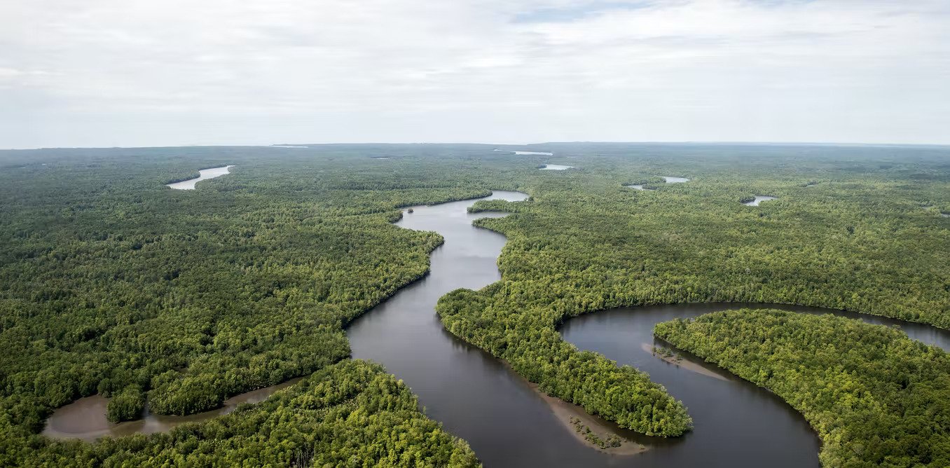
Between 2016 and 2020 , more than 140,000 hectares (346,000 acres) of primary forest were lost in the Venezuelan Amazon . This deforestation was driven by illegal mining, agricultural expansion, and fires. This is stated in a report generated from high-resolution satellite images and published by the Andean Amazon Monitoring Project (MAAP).
This severe deforestation in Venezuela represents 1.6% of the loss of forest cover in the entire Amazon during that period. Other reports confirm this finding.
According to MAAP, most of Venezuela's deforestation hotspots are south of the Orinoco River, in a region designated the Orinoco Mining Arc, which covers 11,000,000 hectares (or an area the size of Cuba), and created by a controversial presidential decree in 2016. Venezuelan President Nicolás Maduro announced that he would promote multinational mining concessions, but the region includes an extensive network of protected areas.
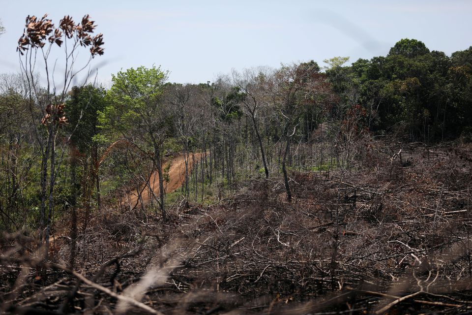
According to the report , the most impacted protected areas within the mining arc presented more than 22,000 hectares of deforestation, which occurred within the Caura, Canaima and Yapacana national parks.
Satellite images have conclusively documented that 550 hectares of forest have been lost since 2000 in the Yapacana National Park, where the presence of the guerrilla forces of the Colombian National Liberation Army (ELN) has increased. Between 2017 and 2020, 1,175 hectares of forest were lost within the Canaima National Park and surroundings. Satellite images show large impacts from the fires in 2019. North of the protected areas, there were more than 1,800 hectares of deforested area due to river mining between 2017 and 2020. Another 400 hectares of forest were cleared for agricultural and livestock use in remote areas. MAAP suspects that these losses were also due to mining, as forest land was likely converted to feed the influx of miners to the region.
Matt Finer, author of the report, told Mongabay that the document is the most up-to-date independent analysis of the Venezuelan Amazon and that it presents all the affected protected areas. He mentioned that future MAAP reports will present similar high-resolution images, which will show in detail the magnitude of the mining camps and the machinery used within the Yapacana National Park.
The findings were obtained by examining the biogeographical area of ​​the Venezuelan Amazon described by the Amazon Georeferenced Socioenvironmental Information Network ( RAISG ), which encompasses the jungle states of Bolívar and Amazonas. MAAP then compared high-quality satellite data from the SOSOrinoco organization with those from Areas Under the Special Administration Regime (ABRAE), which meet the internationally recognized definition of protected areas. The accuracy of the images, with a resolution of 30 meters, was improved by the University of Maryland and presented by Global Forest Watch.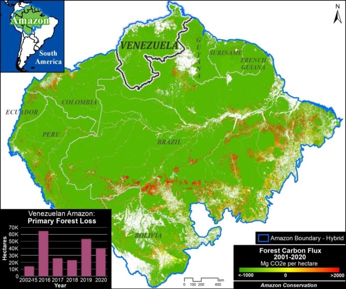
Caura National Park under attack
The MAAP findings highlight two areas deforested for mining in January 2022 within the Caura National Park. This reserve, which was once virgin, covers 7,500,000 hectares and was created in 2017, despite strong criticism from environmentalists and indigenous peoples , who pointed out the lack of scientific studies and the local presence of public institutions capable of monitoring and/or monitor the new park. Read More…