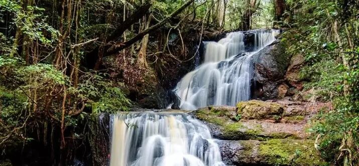
The 6 Best Great Smoky Mountains Waterfalls and Swimming Holes
-
 Loading...
 - Noah Tremblay
- 30 May 2022
- 283 Views
- 0 Like
- 0 Comment
Shared by North Carolina and Tennessee, Great Smoky Mountains National Park is anchored by one of the oldest mountain ranges on earth. As a peak-rippled portion of the extensive Appalachian chain, the Great Smoky Mountains are home to a staggering array of flora and fauna scattered between pine, spruce, and fir forests, among others. And they’re all fed by generous rainfall.
In fact, the Smokies have the highest annual rainfall in the southeastern United States, with higher elevations receiving more than 85 inches every year. However, most of the range’s rain occurs as mist, lending the Great Smoky Mountains their nickname. The amalgamation of altitude and precipitation also makes the Smokies exceptionally biodiverse, earning the national park designations as both a UNESCO World Heritage Site and an International Biosphere Reserve.
The combination of elevation and rainfall also make the Great Smoky Mountain waterfalls numerous and varied, especially with more than 2,100 miles of streams garlanding the national park. However, the rain/elevation combo can also create hazardous trail conditions for hikers, especially along waterways. So before heading out, pack appropriate footwear and check the park’s daily weather advisory – especially during spring and summer, the rainiest seasons in the Smokies.
Thanks to more than 800 miles of marked trails, including a 70-mile stretch of the Appalachian Trail, there’s a lot of mileage to explore. To make it easy, start with these six hikes to Great Smoky Mountains waterfalls for stunning natural sights and some gorgeous swimming holes.
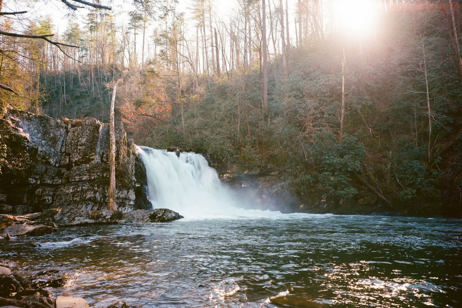
Abrams Falls
- Distance: 5.5 miles
- Elevation gain: +/- 630 feet
- Difficulty: Moderate
Abrams Falls might not be the tallest of the Great Smoky Mountains waterfalls, but the burly cascade packs a visual punch, plummeting about 20 feet into a waiting plunge pool. There are several routes to the falls, but the five-mile, out-and-back hike from the Cades Cove Loop Road trailhead is a manageable option for day-hikers.
En route to the falls, the Abrams Creek Trail threads a stream-laced landscape, weaving through mixed hardwood forests and groves of streamside rhododendron. There are a few minor stream crossings of offshoots of Abrams Creek, so keep an eye out for spots to stop for a dip along the way to the thundering falls.
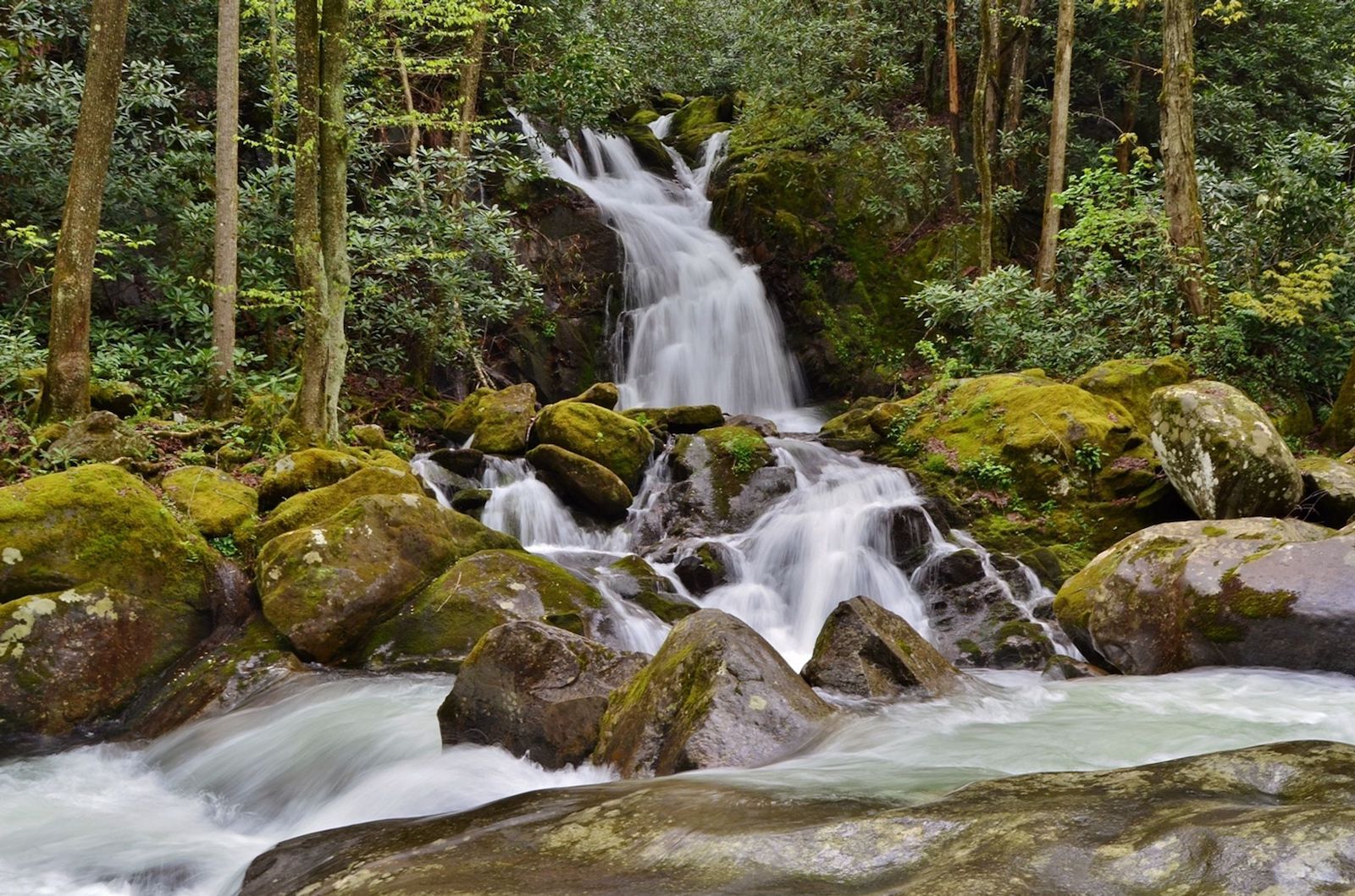
Midnight Hole and Mouse Creek Falls
- Distance: 4 miles
- Elevation gain: +/- 540 feet
- Difficulty: Easy-to-moderate
This hike is actually a twofer, combining a photogenic, natural swimming hole and a secluded waterfall in the Big Creek Valley.
The route starts from the trailhead near the Big Creek Ranger Station and quickly ascends toward the crystalline waters of Big Creek, arriving at the stream after roughly one mile. The trail then parallels the stream until reaching Midnight Hole, the nickname given to the spot where Big Creek spills into a deep pool (about 1.5 miles from the trailhead).
From there, you can continue another .5 miles to a 45-foot-tall Great Smoky Mountains waterfall: Mouse Creek Falls. The cascade is at the intersection of Mouse Creek and Big Creek and stair-steps over turrets of rock to form the multi-tiered falls.
For an overnight excursion, grab a spot at the secluded Big Creek Campground near the trailhead. The tent-only creekside campground is the smallest in the national park, with only 12 sites.
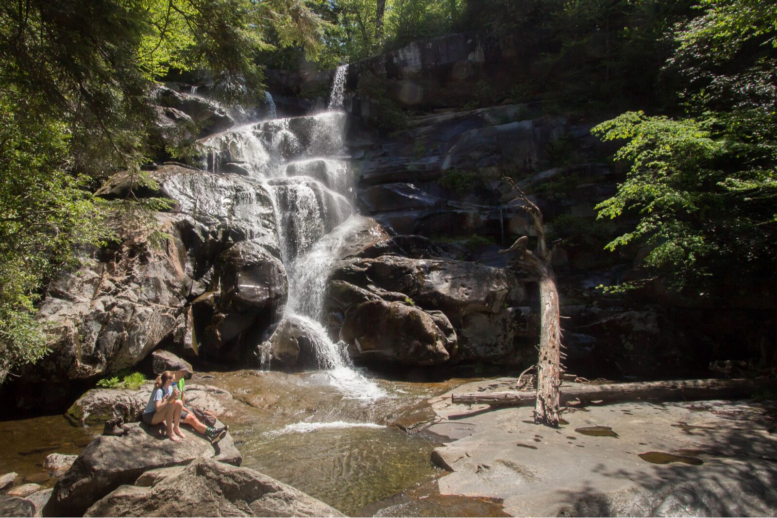
Ramsey Cascades
- Distance: 8.1 miles
- Elevation gain: +/- 2,220 feet
- Difficulty: Challenging
Ramsey Cascades is a sweet reward for sweaty hikers, but the four-mile hike to the tallest Great Smoky Mountains waterfall is grueling. It gains more than 2,000 feet of elevation as it weaves through one of the park’s less-visited areas.
Seek out the lofty waterfall from the marked trailhead for the Ramsey Cascade Trail on Ramsey Prong Road, and be prepared for a full day of hiking that’ll reach more than 4,300 feet in elevation. From the road, the eponymous Ramsey Cascades Trail skirts towering boulders and rockshelters, hugging the banks of the Middle Prong of the Little Pigeon River before climbing to meet Ramsey Prong (a “prong” is a regional term for a small offshoot or stream from a larger river).
For the final two miles, the trail follows Rasmey Prong, rambling through old-growth hardwood forests studded with massive tulip trees, and paralleling a creek pocked with plunge pools. Still, the star of the show is undoubtedly Ramsey Cascade. The postcard-perfect falls marks the end of the route, tumbling over a natural staircase of stacked rocks with a drop of nearly 100 feet.
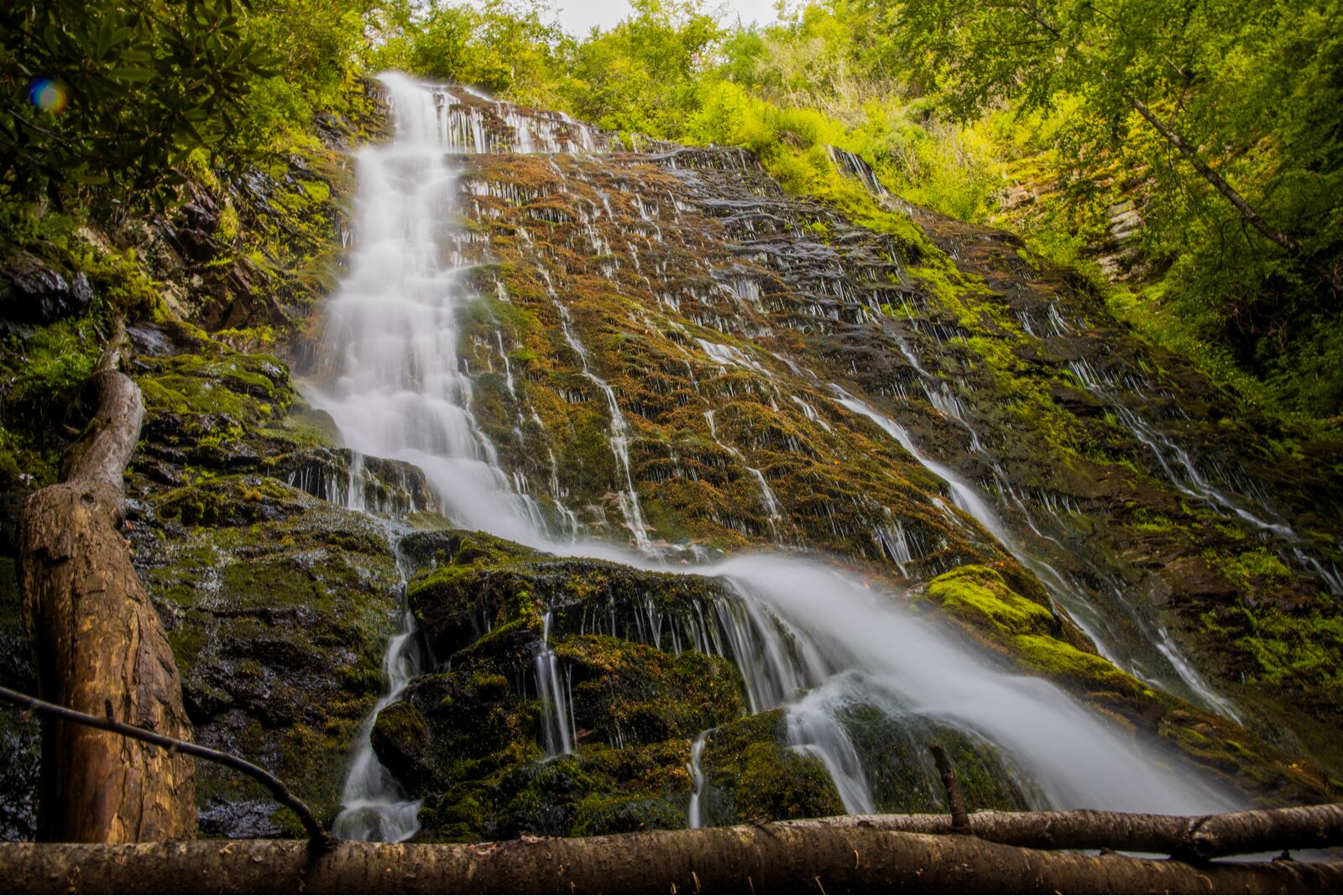
Mingo Falls
- Distance: .3 miles
- Elevation gain: +/- 100 feet
- Difficulty: Easy
Mingo Falls is within the Qaulla Boundary (an area similar to a reservation, except the land is owned by members of the Eastern Band of Cherokee) along the southeastern edge of the Great Smoky National Park.
It’s easy to reach and one of the loftiest Great Smoky Mountains waterfalls in the park. The hike is short, but there’s a climb – up 161 steps, to be precise. The trail begins along the Raven Fork of the Oconaluftee River, about six miles northeast of the park’s Oconaluftee Visitor Center. For a photogenic view of the falls, follow the steadily uphill Pigeon Creek Trail for just under half a mile to a strategic viewing platform, offering an unobstructed view as Mingo Creek glides through the Raven Fork Gorge and eventually tumbles into a slender, silvery 120-foot-tall ribbon of water. Read More...