The 8 best hikes in Guatemala, from volcano trails to jungle jaunts
-
 Loading...
 - Alicia Davies
- 25 Apr 2022
- 323 Views
- 0 Like
- 0 Comment
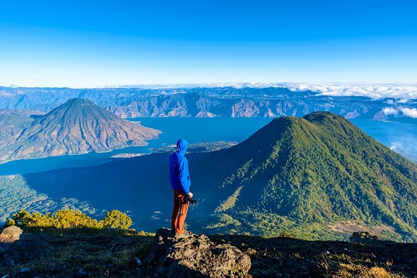
Most of the country’s best treks are located in the highlands, a region defined by a chain of smoking volcanoes to the south and the Sierra de los Cuchumatanes mountain range to the north. With the high elevation, hikers pass through a striking range of vegetation zones, from tropical jungles and pine forests to the altiplano, where everything is wrapped in a shroud of mist.
In the northern jungles of El Petén, multi-day treks take visitors to the ruins of the largest recorded Mayan city, accessible only on foot, where ancient pyramids are swallowed by lush vegetation and haunted by howler monkeys and chittering toucans.
Here are eight of the best hikes in Guatemala for those who love to climb the highest peaks and explore the densest jungles.
The practicalities of trekking in Guatemala
While treks abound, getting to the trailheads for many of Guatemala’s best hikes can be a little tricky, especially if you don’t speak Spanish. The trails themselves can also be confusing, particularly in the tropical lowlands, so we recommend hiring a local guide to show you the way. Guides are easy to find in most areas popular with trekkers – ask around at your accommodation or contact local tour agencies.
Though hiking is a popular activity in Guatemala, you may have the trails all to yourself in some areas, and an experienced guide will reduce the chances of accidentally taking a wrong turn or running into trouble. Guatemala’s weather is generally temperate but the tops of volcanoes can get chilly (below freezing sometimes), so bring a few extra layers, no matter how short the trek.
Volcán Acatenango
Best volcano hike
18km (11 miles) round trip, 6–8 hours or overnight, challenging
Trekking to the summit of 3976m (13,045ft) Volcán Acatenango is probably the most talked-about travel experience in Guatemala – and with good reason. This overnight hike provides dramatic views of glowing orange lava erupting from nearby Volcán El Fuego against the backdrop of an impossibly starry sky.
The hike is not technically difficult, but the trail is steep and the terrain varied, so it’s considered tough, even by the standards of experienced hikers. Expect a walk that cuts through farms and cloud forests and crunches over volcanic gravel before leveling out at a sandy crater with views of surrounding volcanoes and the Cuchumatanes mountains.
Most guides set up tents for the night at the base camp below the summit, for a direct view of El Fuego. The next morning, you can climb to the peak to watch the sunrise. Acatenango can also be hiked in a single day, but without the overnight stay, you'll miss the best part of the show.

Volcán Pacaya
Best hike near Guatemala City
6km (3.7 miles) round trip, 2–3 hours, moderate
Volcán Pacaya is Guatemala’s most popular hike, being short, moderately easy and close to Antigua (and not far from Guatemala City). For the same reasons, the trail is a favorite with trail runners, so don’t be surprised if you see athletes whizzing by as you amble up the trail.
The first hour of hiking is the hardest because of the steep gradient of the trail, which takes you through forests and farmland. After that, it’s a fairly painless climb uphill to reach lava fields that have cooled enough to walk on, but are still hot enough to roast marshmallows – guides can provide them, but if you're hiking on your own, pick up a bag from one of the vendors at the beginning of the trail.
One of the nice things about the Volcán Pacaya trek is the number of resting points along the way, most with vendors selling drinks and local snacks such as oranges sliced in half and topped with ground pumpkin seeds.
If you're concerned about having enough stamina to make it to the top, it’s possible to hire someone to walk beside you with a horse that you can ride if you get tired, for a modest fee. The summit provides amazing views of neighboring volcanoes Agua, Fuego and Acatenango. Many companies combine the hike with a visit to the nearby Santa Teresita thermal pools, for a soak in the hot water after the hike.
Volcán Tajumulco
Best hike for bragging rights
13km (8 miles) round trip, 6–8 hours, challenging
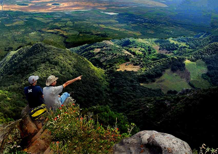
Rising to a whopping 4200m (13,780ft), Volcán Tajumulco is not only the tallest volcano in Guatemala, it's the highest point in Central America. Conquering the summit is a badge of honor that experienced hikers won’t want to miss. Despite Tajumulco’s impressive height, it only takes about five hours to reach the top; if you are lucky enough to have clear skies at the summit, you'll be rewarded with views of both Mexico and El Salvador on either side.
The Volcán Tajumulco hike is more technical than other trails in Guatemala. In parts, it’s necessary to maneuver over boulders and rocky outcrops, and the trails are not well marked, so it’s essential to go with a guide. Arrange your adventure in Quetzaltenango, where you should stop for a couple of days to acclimatize before climbing Tajumulco. Read More…