10 top hikes in Malaysia for modern-day adventurers
The Malaysian peninsula is split in two by the 2183m (7162ft) Titiwangsa Range – the last refuge for the country's elusive population of wild tigers and Asian elephants. This hilly backbone fractures into dozens of lesser hills and peaks spilling all the way to the jungle-backed coastline, where more foliage-clad islands await.
Across the South China Sea in the Malaysian part of Borneo, more mountain ranges and limestone massifs soar above the verdant rainforests of Sabah and Sarawak, offering still more chances to get off the beaten track and test your limits.
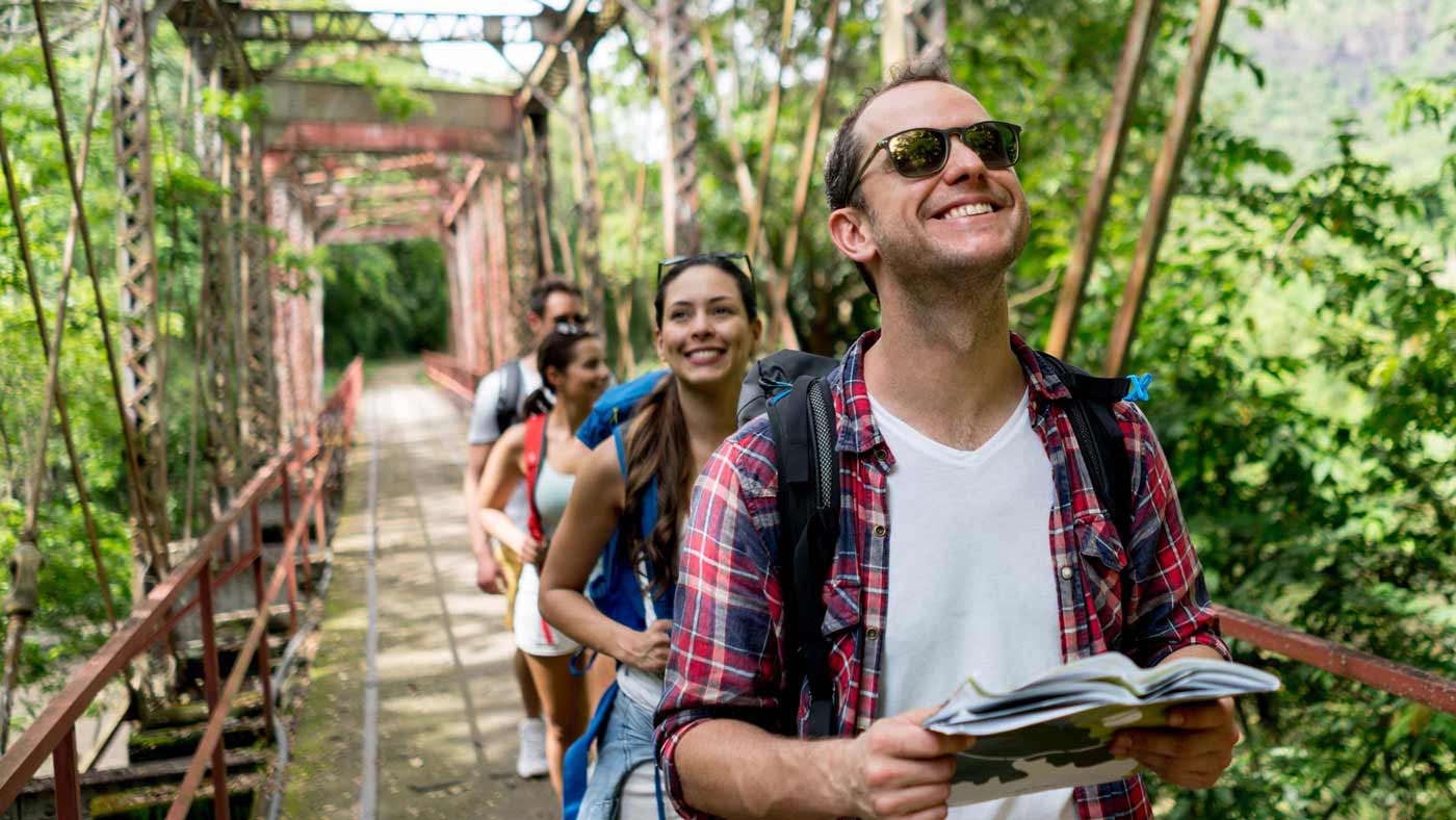
Ready for some sweaty tropical workouts? Then lace up your hiking boots, bring plenty of water, and don’t forget to pack a pair of leech socks... Here are the 10 best hikes in Malaysia.
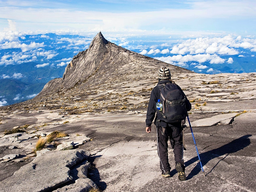
Mt Kinabalu, Sabah
Best high-altitude multi-day hike
8.5km (5.25 miles), 2 days, easy to moderate
Rising like a pointy fang from the jungles of northern Borneo, Mt Kinabalu is Malaysia’s highest peak, and it's a sacred site for the indigenous Kadazan-Dusun people of Sabah. The clouds that seem to perennially shroud its 4095m (13,435ft) summit – known since colonial times as Low's Peak – are believed to be formed from the resting souls of their ancestors.
Getting to the top of Low’s Peak is a physically challenging but relatively straightforward climb starting from the Timphoon Gate, beyond the flower-studded park that covers the lower slopes of the mountain. The trail winds up through mossy forests draped with orchids and clumps of pitcher plants and colorful stands of rhododendrons up to 3000m (9843ft), where hikers spend the night at one of several rest houses.
The final push for the summit involves a 2am start, timed to deliver hikers to Mt Kinabalu’s barren, wave-like tip as the sunrise explodes in myriad shades of purple above a quintessentially Malaysian awan karpet (carpet of clouds).
Penang Hill, George Town
Best urban hike
5.8km (3.6 miles) round trip, 4–6 hours, moderate
Mention Penang, and most will think of the street art, hip cafes and colonial architecture of its capital George Town, not the forested hills stretching from the town limits to the northwestern corner of the island. This natural wonderland covers 12,481 hectares of marine and terrestrial ecosystems, but most visitors see just the small section around Penang Hill – colonial Malaya’s first hill station, famed for its views over the Straits Sea and the Malaysian mainland.
Since 2021, this expanse of forest has been protected as Malaysia's third Unesco Biosphere Reserve. The most popular way to reach the 830m (2723ft) summit is on one of the world’s steepest funicular railways, but we recommend taking the scenic route via the tangle of interconnected jungle trails that snake their way up the hill from Penang Botanical Gardens. You can also start the hike from Penang City Park (aka Youth Park), or from Moongate, a circular Chinese gateway that was once the gateway to a millionaire’s estate.
The most straightforward route is the Heritage Trail, a knee-grinding staircase ascent that follows the steep tracks of the funicular railway, but it's more rewarding to take more circuitous jungle trails. There's a good chance of encounters with endangered and endemic flying lemurs, dusky leaf monkeys, hooting macaques and a staggering 144 different types of orchids.
If you have the time and stamina, after reaching the top of Penang Hill, you can continue for a further five hours through dense dipterocarp forest to the top of 725m (2378ft) Laksamana Hill, Penang’s second-highest peak. Wind up by descending to the beaches at Teluk Bahang for a well-deserved rest, before taking the Rapid Penang bus back to George Town.

Bukit Beruang, Melaka
Best easy day hike
5km (3.1 miles) round trip, 2–3 hours, easy to moderate
Rising above the Portuguese churches, Chinese shrines and river-facing guesthouses of former Dutch enclave, Melaka, Bukit Beruang (Bear Hill) doesn't seem like a tough hike. The summit is just 116m (381ft) above sea level. But it all depends on which of the three trails to the summit you take. For the easy option, walk up via the 2.5km (1.5 mile) paved road to the telecommunications tower that dominates the hilltop.
If you want something more fun, two sweatier and more inspiring trails climb through thick walls of forest on the other side of the hill. Pick up these well-marked paths in either Taman Bunga Raya or Taman Muzzaffar Height. However you reach the top, proceed from the tower to the nearby lookout point known as "Eye on Melaka," where the historic streets loom into view.
Bukit Larut (Maxwell Hill)
Best hill station hike
20km (12 miles) round trip, 10 hours, moderate
Malaysia’s second-oldest hill station opened in 1884 at the top of 1250m (4101ft) Bukit Larut, also known as Maxwell Hill. This steep range of viridian hills stands like a protective fan above the exquisite lake town of Taiping. The route to the top of Bukit Larut wasn’t a very attractive affair until the end of 2021, when the organizing committee responsible for the yearly Malaysia Mountain Trail Festival opened three new summit paths through the jungle, as an alternative to the paved road used by jeeps.
These trails snake from the base of the mountain to the Box, one of the old colonial bungalows that pepper the atmospheric mist-covered summit of the hill, and the skeletal Telecom Tower that dominates the far side of the ridge. To make the climb, you'll need a RM10 (US$2.40) permit and a mandatory guide (RM15/US$3.60).
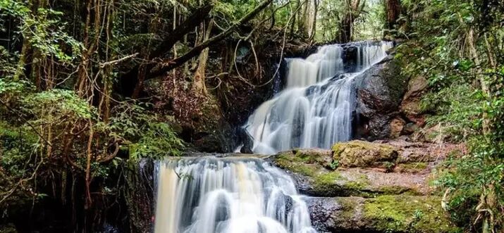
At 350m (1148ft), take a stop at the sloshing Ranting Waterfall before making a steep ascent through ancient dipterocarp forests that thicken as the trail climbs into the clouds. Beware of the leeches, and don’t forget to carry a raincoat, as bouts of heavy rain are almost daily occurrences in Taiping. The bungalows on the top are open for group stays, or you can camp (RM20/US$4.80) near the waterfall or at the bottom of the hill. Read More...