The European Space Agency has published stunning images of the deepest canyon in the Solar System
-
 Loading...
 - Jacob Bernard
- 28 Jul 2022
- 101 Views
- 0 Like
- 0 Comment
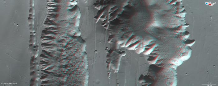
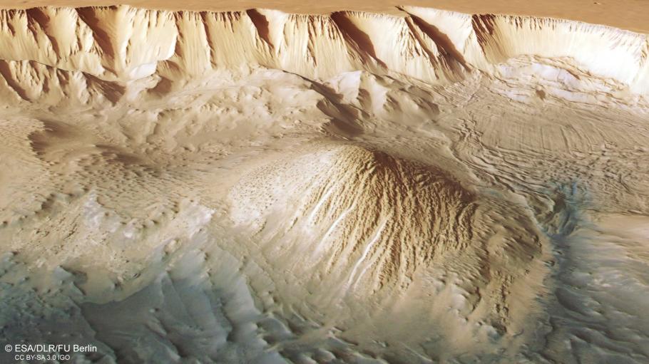
The European Space Agency has published a new set of images taken by satellites orbiting above the planet Mars, which are part of the Mars Express mission. The experts who presented the photos explain that Valles Marineris was captured in them, a geological formation 20 times larger than the Grand Canyon on our planet, Futurism notes.
The photos were taken during April, but were released to the public recently. A deep chasm can be seen in them, which stands out due to the orange sand, nearby rocks and impact craters in the region.
Scientists who have studied this part of Mars believe that this canyon was not formed like those on Earth. More precisely, while on our planet it is water that shapes these geological structures, in the case of Valles Marineris it was the movement of tectonic plates.
The Mars Express mission
Mars Express has been orbiting the red planet since 2003, exploring the surface of Mars, mapping its minerals, identifying the composition and circulation of its rarefied atmosphere, probing beneath its crust, and exploring how various phenomena interact in the Martian environment.
The mission's High Resolution Stereo Camera (HRSC), responsible for these new images, revealed many details about Mars ' surface features , and the recent images capture everything from wind-carved ridges and grooves to impact craters and channels that once carried liquid water to volcanoes, river channels and ancient lava pools.