Home Upload Photo Upload Videos Write a Blog Analytics Messaging Streaming Create Adverts Creators Program
Bebuzee Afghanistan Bebuzee Albania Bebuzee Algeria Bebuzee Andorra Bebuzee Angola Bebuzee Antigua and Barbuda Bebuzee Argentina Bebuzee Armenia Bebuzee Australia Bebuzee Austria Bebuzee Azerbaijan Bebuzee Bahamas Bebuzee Bahrain Bebuzee Bangladesh Bebuzee Barbados Bebuzee Belarus Bebuzee Belgium Bebuzee Belize Bebuzee Benin Bebuzee Bhutan Bebuzee Bolivia Bebuzee Bosnia and Herzegovina Bebuzee Botswana Bebuzee Brazil Bebuzee Brunei Bebuzee Bulgaria Bebuzee Burkina Faso Bebuzee Burundi Bebuzee Cabo Verde Bebuzee Cambodia Bebuzee Cameroon Bebuzee Canada Bebuzee Central African Republic Bebuzee Chad Bebuzee Chile Bebuzee China Bebuzee Colombia Bebuzee Comoros Bebuzee Costa Rica Bebuzee Côte d'Ivoire Bebuzee Croatia Bebuzee Cuba Bebuzee Cyprus Bebuzee Czech Republic Bebuzee Democratic Republic of the Congo Bebuzee Denmark Bebuzee Djibouti Bebuzee Dominica Bebuzee Dominican Republic Bebuzee Ecuador Bebuzee Egypt Bebuzee El Salvador Bebuzee Equatorial Guinea Bebuzee Eritrea Bebuzee Estonia Bebuzee Eswatini Bebuzee Ethiopia Bebuzee Fiji Bebuzee Finland Bebuzee France Bebuzee Gabon Bebuzee Gambia Bebuzee Georgia Bebuzee Germany Bebuzee Ghana Bebuzee Greece Bebuzee Grenada Bebuzee Guatemala Bebuzee Guinea Bebuzee Guinea-Bissau Bebuzee Guyana Bebuzee Haiti Bebuzee Honduras Bebuzee Hong Kong Bebuzee Hungary Bebuzee Iceland Bebuzee India Bebuzee Indonesia Bebuzee Iran Bebuzee Iraq Bebuzee Ireland Bebuzee Israel Bebuzee Italy Bebuzee Jamaica Bebuzee Japan Bebuzee Jordan Bebuzee Kazakhstan Bebuzee Kenya Bebuzee Kiribati Bebuzee Kuwait Bebuzee Kyrgyzstan Bebuzee Laos Bebuzee Latvia Bebuzee Lebanon Bebuzee Lesotho Bebuzee Liberia Bebuzee Libya Bebuzee Liechtenstein Bebuzee Lithuania Bebuzee Luxembourg Bebuzee Madagascar Bebuzee Malawi Bebuzee Malaysia Bebuzee Maldives Bebuzee Mali Bebuzee Malta Bebuzee Marshall Islands Bebuzee Mauritania Bebuzee Mauritius Bebuzee Mexico Bebuzee Micronesia Bebuzee Moldova Bebuzee Monaco Bebuzee Mongolia Bebuzee Montenegro Bebuzee Morocco Bebuzee Mozambique Bebuzee Myanmar Bebuzee Namibia Bebuzee Nauru Bebuzee Nepal Bebuzee Netherlands Bebuzee New Zealand Bebuzee Nicaragua Bebuzee Niger Bebuzee Nigeria Bebuzee North Korea Bebuzee North Macedonia Bebuzee Norway Bebuzee Oman Bebuzee Pakistan Bebuzee Palau Bebuzee Panama Bebuzee Papua New Guinea Bebuzee Paraguay Bebuzee Peru Bebuzee Philippines Bebuzee Poland Bebuzee Portugal Bebuzee Qatar Bebuzee Republic of the Congo Bebuzee Romania Bebuzee Russia Bebuzee Rwanda Bebuzee Saint Kitts and Nevis Bebuzee Saint Lucia Bebuzee Saint Vincent and the Grenadines Bebuzee Samoa Bebuzee San Marino Bebuzee São Tomé and Príncipe Bebuzee Saudi Arabia Bebuzee Senegal Bebuzee Serbia Bebuzee Seychelles Bebuzee Sierra Leone Bebuzee Singapore Bebuzee Slovakia Bebuzee Slovenia Bebuzee Solomon Islands Bebuzee Somalia Bebuzee South Africa Bebuzee South Korea Bebuzee South Sudan Bebuzee Spain Bebuzee Sri Lanka Bebuzee Sudan Bebuzee Suriname Bebuzee Sweden Bebuzee Switzerland Bebuzee Syria Bebuzee Taiwan Bebuzee Tajikistan Bebuzee Tanzania Bebuzee Thailand Bebuzee Timor-Leste Bebuzee Togo Bebuzee Tonga Bebuzee Trinidad and Tobago Bebuzee Tunisia Bebuzee Turkey Bebuzee Turkmenistan Bebuzee Tuvalu Bebuzee Uganda Bebuzee Ukraine Bebuzee United Arab Emirates Bebuzee United Kingdom Bebuzee Uruguay Bebuzee Uzbekistan Bebuzee Vanuatu Bebuzee Venezuela Bebuzee Vietnam Bebuzee World Wide Bebuzee Yemen Bebuzee Zambia Bebuzee Zimbabwe
Blog Image

How to Check for Snow on the Trail

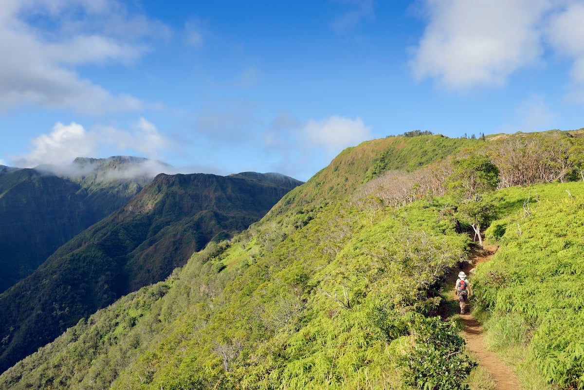
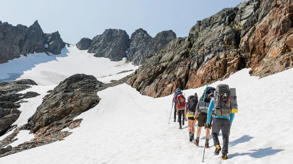
Spring is a few weeks away, and the trails will be melting out before you know it. But conditions at the parking lot do not necessarily tell you what the trail looks like up ahead. Even well into summer, snow can cling to high mountain passes. Lingering cornices and deep snowdrifts can be onerous and present obstacles.

Plus, mountain weather can turn on a dime. A warm, sunny day can quickly escalate into a freezing cold whiteout blizzard.

Thankfully, you can use Gaia GPS to help eliminate this guesswork of whether the trails will be sunny and snow-free. In this guide, you will learn how to use recent satellite imagery (FreshSat—Recent and Cloud Free layers), snow depth total estimates (Snow Depth layer), actual snowfall data (Snow Stations Daily layer), and Precipitation and Snow Forecasts to get a sense of how much snow may be on your hike or overlanding trip. You’ll also learn how to use these maps in conjunction with the best community resources to make informed decisions about where to go and what to bring.

Get a Bird’s-Eye View with FreshSat–Recent & Cloud Free

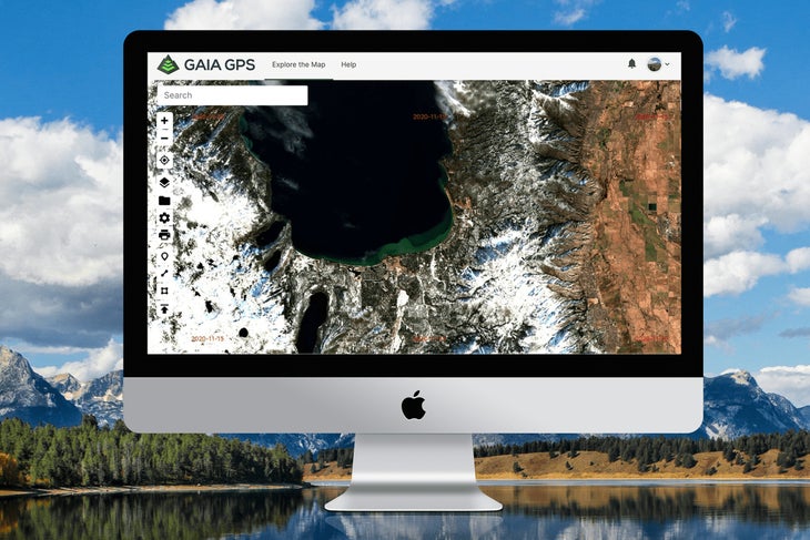
If you’re wondering whether you need crampons and an ice ax to climb your next fourteener, start by examining the FreshSat layers. These maps provide a near-in-time aerial view of conditions on the ground.

By nature of their source, these images are lower resolution than our other satellite maps. But they provide the most updated views of the terrain and conditions, which proves helpful if you want to see where snow lingers on remote mountain and forested areas. For a more crystal-clear areal view, check out the high-resolution Satellite layers.

FreshSat–Recent and FreshSat–Cloud Free both give you a snapshot of relatively up-to-date ground conditions. FreshSat–Cloud Free shows a mostly unobstructed view of the earth’s surface. FreshSat–Recent provides an even more up-to-date picture of ground conditions, but clouds may obstruct some of the view.

Both maps are updated at least every 14 days using data from Landsat-8 and Sentinel-2 government satellites. Date stamps on both FreshSat maps make it easy to identify how recently a location has been updated. Simply look at the corner of a map tile to see the date when that image was taken.

Layer these maps with your favorite base map, such as Gaia Topo, to examine the route for your trip. Start by scoping out FreshSat—Recent. If the area is obstructed by clouds, head over to FreshSat—Cloud Free. Zoom into the high points of your route, north-facing slopes, and forested areas to look for signs of snow.

Check Estimated Snow Depth Totals with the Snow Depth Layer

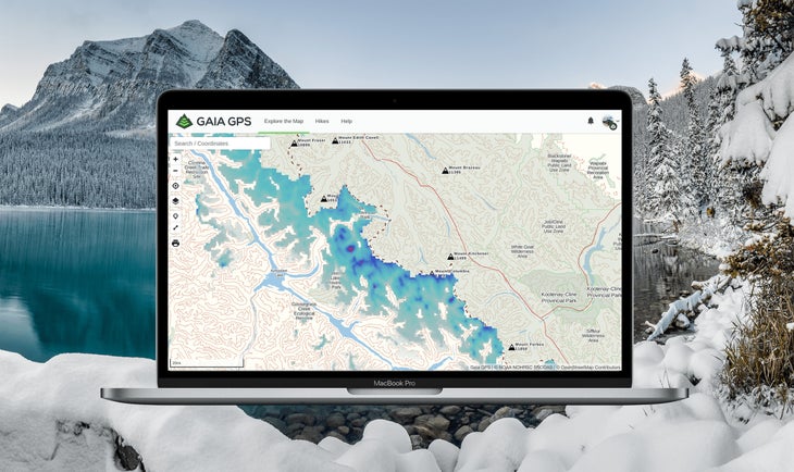
Inspired by a thru-hiker looking to track snow depths along the Pacific Crest Trail with Gaia GPS, the Snow Depth overlay gives you an estimate of snow levels covering your next route. Outdoor adventurers can examine how many centimeters of snow most likely exist in specific areas by referencing color-coded indicators of coverage.

In fact, thru-hiker Joe “Stringbean” McConaughy used this map religiously on his recent record-setting Arizona Trail “run.” Stringbean referenced this layer to get a sense of when he might encounter snow on the high-elevation sections of the trail. To do this for your next trip, just place this overlay on top of your base map. Tweak the opacity to get a picture of how much snow may be on the trail. Read More...

Previous Post

Top 10 Pieces of Advice for Beginner Thru-Hikers

Next Post

The Benefits of Bike Riding

Comments