Tiny, Inexpensive Satellites Can Monitor Harmful Gases From Space
-
 Loading...
 - Maire Dunne
- 04 Jul 2022
- 121 Views
- 0 Like
- 0 Comment
The Earth’s atmosphere is mostly composed of nitrogen and oxygen, but dilute trace gases, both from natural sources and human activities, play an important role in the environment, climate and human health. These gases include the more than 50 billion tons of greenhouse gases the world collectively emits into the atmosphere every year, including carbon dioxide, methane, nitrous oxide and others.
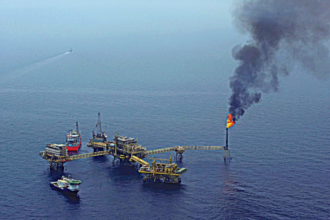
But many other trace gases are also significant, such as nitrogen dioxide, which gives urban smog its familiar brown color; tropospheric ozone, which causes many of smog’s negative health impacts; and sulfur dioxide, which causes acid rain. These are largely produced by human activity—power plants and fossil fuel-based vehicles—but volcanoes and agricultural activities are other sources.
A key piece of successful pollution prevention strategies is identifying sources of these pollutant trace gases and understanding their chemical reactions in the atmosphere as they move downwind. A long sought-after goal in this area has been to identify sources from space. While some existing satellites can monitor these gases on a coarse regional scale, none has the spatial resolution to see crucial finer-scale details, such as pollutant chemistry within cities, or the early sulfur dioxide emissions from awakening volcanoes.
Furthermore, satellite instruments capable of measuring trace gases have traditionally been large, heavy and power hungry, requiring large satellite hosts that are expensive to develop and launch. This makes deploying a high-resolution, trace-gas monitoring capability using traditional technology a very expensive proposition.
New technology developed at Los Alamos National Laboratory may provide a solution. The NanoSat Atmospheric Chemistry Hyperspectral Observation System, or NACHOS, is the first-ever CubeSat-based hyperspectral imaging system that can compete with traditional large-satellite instruments in chemical detection applications. Hyperspectral imaging is conceptually similar to color imaging, except that instead of each pixel containing just the three familiar red, green and blue channels that mimic human vision, each pixel contains hundreds of wavelength bands, analyzing the light in great detail in order to spot the unique spectral fingerprint of each gas of interest.
The system uses spherical mirrors that are easy to manufacture, have high optical throughput (allowing a lot of light for maximum sensitivity) and can fit on a satellite that is roughly the size of a loaf of bread. Its high-spatial resolution allows researchers to see gases not at a regional scale but at the neighborhood scale and could even see emissions from individual power plants from its low-Earth orbit vantage point more than 300 miles up.
It can be used in a variety of scientific applications, including monitoring tropospheric ozone (one of the most health-damaging components of urban smog), detecting formaldehyde from wildfires and identifying and distinguishing between scattering and absorbing aerosols in the atmosphere, a crucial factor in understanding climate change.
In addition to pollution monitoring, these powerful imagers can improve public safety. The high-resolution cameras can detect low levels of volcanic degassing and help provide insight into when a volcano might erupt.
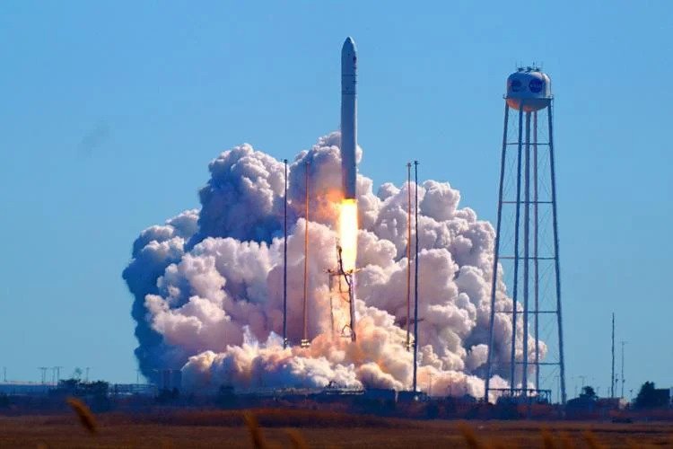
The first NACHOS CubeSat was launched on Feb. 19 aboard the Northrop-Grumman NG-17 Cygnus space station resupply vehicle, which is now docked at the ISS. In the first tests, which will commence later this year after Cygnus undocks and deploys NACHOS to its final orbit, the research team will be looking at chemical emissions from representative sites, such as the coal-fired Four Corners Power Plant and San Juan Generating Station in New Mexico, the Los Angeles Basin, Mexico City and Popocatépetl, the nearby active volcano that looms over that city. The data collected from this project will help to better understand pollution in these regions, improve air quality predictions and provide valuable scientific data to volcanologists.
While hyperspectral imaging is a powerful technique, it produces vast amounts of data that can take hours to downlink in raw form. So, another crucial goal of these tests is to assess NACHOS’ unique onboard image-processing capability, which will drastically shorten the time it takes to downlink. NACHOS uses newly developed, computationally efficient algorithms that can rapidly extract gas signatures from massive hyperspectral datasets, taking just minutes to do so even on the CubeSat’s tiny computer.
When combined into a constellation of other CubeSats, these imagers could provide atmospheric monitoring with high-spatial resolution and near-continuous observation of key areas. A second NACHOS CubeSat is scheduled to launch this summer. Potentially, these constellations could use an inter-satellite tipping and cueing scheme, where one satellite detects an irregular event, then signals other satellites with different capabilities to identify the cause. Even more detailed observations are planned, in which the two CubeSats will be joined by ground-based versions of the NACHOS hyperspectral instrument in simultaneous observations to produce detailed 3D maps of pollutant gas plumes. Read More...